Parish Paths Partnership


The following notes are the leader's speaking notes, with route directions added in italics. Anybody considering the walk would be advised to use either the OS 1:25,000 Explorer Sheet 192 or the OS 1:50,000 Landranger Sheet 165, and Grid References have been given in the route directions.
Start at the village pump (GR925280) and walk towards Leighton Buzzard as far as the village pond (GR924275) opposite Shenley Hill Road. On the way you will pass:
Heath & Reach
The almshouses
Opposite the Axe and Compass pub, and now called Rose Cottage. See notes below on The Church.
The Vicarage
Built in 1852 for £600 and extended in 1869. Sold by the church in 1967 for £6750. Now six flats and a Coach House, and the last flat to be sold went on the market for £180,000.
There is an 80ft well under one of the downstairs flats on the site of the old scullery.
The land was given by the occupants of the manor, who also sold the plot for the burial ground to the parish for £81 at the same time. The direct footpath from the church to Lanes End was diverted onto what is now FP 8, and the diversion is recorded in the minutes of the County Quarter Sessions.
The Church
This was built in 1695 at the same time as the manor house and the almshouses. It is said that it was removed from its former site on Sheepcote corner, where there had been a chapel since the 15th Century, and rebuilt opposite the manor as the family chapel "in which the villagers were permitted to worship". The house, chapel and almshouses were all built for £2000.
The tower is the only part which remains of the 17th Century church. The Nave was rebuilt in 1829, the Chancel was added in 1866 during major restoration, and the South Porch was added in 1876.
Inside the church is the basin of an old font said to be 15th Century (probably from the chapel), and two collection plates dated 1697.
There are apparently records which say that there was a church on this site between 1150 and 1250, and during the 1866 restoration some mediaeval tiles and early Tudor bricks were found in the foundations - but of course they could have come from the chapel.
The Manor
Built in 1695 for the Welles family. In the early 18th Century it was occupied by the Franks, and in 1703 John Frank married Elizabeth Wigg of Heath. The family chapel became a parish church in 1704 when Elizabeth gave it to the parish.
The house has 24 rooms (not counting garrets) of which 6 are wainscoted. There is a fine Jacobean staircase and, on the roof, two plaster panels, which are visible from the road below the house. One of these represents Adam and Eve, the other the Tudor Rose and Crown, and these ornaments are repeated inside the house. Village tradition says that these panels were removed from the old chapel at Sheepcote corner, and that the ladies who removed them will haunt the house until the panels are returned to the church.
There is another tradition that the house has an underground passage. Apparently there is a bricked-up arch in the cellar.
The house has two wells, one in the garden and one in the cellar.
ROUTE DIRECTIONS
At the village pond you have reached the southern boundary of Heath and Reach, and you will "walk the bounds" all the way to the A5 (Watling Street). Walk along Shenley Hill Road. The pond is in Heath and Reach, but the houses on your left are in Leighton Buzzard. At the end of the houses the boundary is on the road. Rest at the top of the hill by the reservoir to get your breath and enjoy the view. Continue down the hill, past the Tidy Tip, across the narrow gauge railway to the cross-roads (GR939270). Turn left here and after 300 metres you will turn right onto a signed bridleway.
Follow the yellow waymark signs. The parish boundary is initially along the hedge to your right (with Eggington on the other side) and later, when you join the Winterbourne Brook, along the brook. Look out for the unique double-gated bridge on your right at the first culvert.
Cross another culvert bridge, but ignore the first handrail bridge (GR948275) on your right over the Winterbourne, which leads to Hockliffe. Go round the old and usually dry "ox-bow" bend in the brook and across the first arable field to the second handrail bridge (GR952279), which you cross. Follow the waymark signs around the field to the A5 (GR956283). The parish boundary (with Hockliffe on the other side) follows the brook to your right. Go up the ramp onto the A5, and cross this main road onto the footpath to the right of the lodge.
You have just left Heath and Reach - the boundary turns left along Watling Street, and you are in Battlesden parish. Walk to the top of the hill in front of you, and pause again for breath and to look down on Battlesden park and church.
Battlesden
Is mentioned in Domesday Book of 1086 as the manor of Badelsdone, and the park is first mentioned in 1334. The church dates from about 1280, with a later tower which immediately developed a lean and had to be firmly buttressed.
The history of the estate is well recorded, and in 1603 it passed into the hands of the Dunscombes. As recently as 1897 the Charity Commissioners were involved in managing a Dunscombe charity to use £100 per year to distribute coal and groceries to ten households in Battlesden and Potsgrove.
Sir Gregory Page, a director of the East India Company, acquired the estate in 1724. His great-nephew, Sir Gregory Page-Turner, inherited the estate at the end of the 18th century. Page-Turner was described as "an immensely rich young baronet who commissioned artists and architects in a wild and capricious manner"! Page-Turner built a country house in the style of a French chateau, and employed Humphrey Repton in 1808 to lay out formal gardens. In 1818 he commissioned the artist Shepherd to paint a watercolour of the gardens, showing conservatories in a luxurious flower setting with, in the background "a rustic cottage and church tower". There is now a large house beside the church called The Garden House (currently being extensively renovated) which is most likely to be the Rectory, which has been described as "standing in the park". In 1821 Sir Joseph Paxton was employed to landscape the park and lakes.
In 1823 Page-Turner was declared bankrupt with liabilities of £100,000.
The estate was acquired by the Duke of Bedford in 1884 and incorporated into the Woburn estates. In 1885 the Duke demolished the chateau, keeping only the stable block for use as a shooting box. The Duke erected the four estate cottages in the village between 1887 and 1888. The two farms were described as "modern buildings" in 1912.

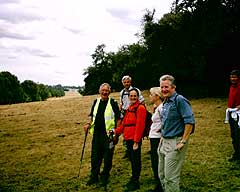
Continue down the hill away from the A5 to a tarmac road (GR963289) where you turn left towards the church (see photo). At the gate beside the church follow the footpath signs past the current Battlesden House, which is the old stable block! Walk on down the drive for 300 metres to an unsigned junction (GR960296) where you turn left downhill (this is a right of way). You will see Potsgrove at the top of the hill opposite. Walk on to Potsgrove.
Is also mentioned in Domesday Book (as Potesgrava). The church dates from 1320-1340 and has some 12th and 13th Century stonework. JD Sledding, who was closely involved with the Arts and Crafts movement, restored the church in 1881 and the Churches Conservation Trust now maintains it. There is a site of a moated manor house, where the moat is still visible, south of the church on the other side of the road.
The history of Potsgrove closely matches that of Battlesden, and in 1884 the Duke of Bedford bought the manor from the trustees of Sir Gregory Page-Turner, incorporating the lands into the Woburn estates. The Duke built a school opposite the church in 1897.
By 1912 it was said that the greater part of the population lived in Sheeplane, a hamlet about a mile north of Potsgrove. Sheeplane was described as having two chapels (Baptist and Methodist) and a combined church and school built in 1862 because the villagers were seen to be of "sunken condition and spiritual destitution". The Methodist chapel was converted in 1978 into Chapel Cottage near the Flying Fox. The church/school was described as "standing at the head of the street - from here a by-way leads to a moat", so it was probably at the corner of Woburn Road and the road to Potsgrove.
This moat is clearly visible on the ground. It is marked on OS maps and is known as Lovell's Bury or Lovell's Hoult (seen on the return journey).
Walk on along the lane with the church on your right and the converted schoolhouse on your left. At the cattle grid (GR949305) you cross the tarmac road and walk diagonally across the arable field to the right of the bushes just showing above the brow of the hill. Keep going in a straight line to the corner of the field (completing the diagonal) and you will find a small yellow waymark (GR947311). Turn right.
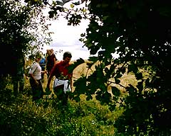
Follow waymark signs through one field boundary, and half way down the second field zigzag through the hedge on your right but continue in the same direction. At the end of the field, at the cross track (GR949316), turn left (see photo - Note: this next bit is a diversion to avoid a foul footpath, but if you are confident of your navigation you could go straight on (on rights of way) into Woburn).


Information Centre
Woburn has an excellent information centre in the redundant High Street church, with much photographic and pictorial data. The village is recorded earlier than Domesday, and the history includes a civil war siege.
The Russell Family
They trace their history back to 1394. It was John, one of Henry VIII?s most influential bureaucrats, who established the family fortunes, and Henry appointed him Baron Russell and Earl of Bedford, and awarded him considerable estates. However, it was Henry's son, Edward VI, who granted Woburn to Sir John Russell in 1547.
The Abbey
The Abbey was established in 1145 as a religious house and it existed for 400 years. Then, in 1538 the Abbot was found guilty of treason and apparently hanged from an oak tree at the Abbey gate.
Although Sir John acquired Woburn in 1547, it did not become a family home until 1619, when the house was built over the religious settlement. The North Wing is above the monastic church and the courtyard is on the site of the great cloister.
The great state rooms were created in 1747 and the park was landscaped by Humphrey Repton in 1802.
The main front is built from local limestone quarried at Totternhoe.
ROUTE DIRECTIONS
Return to the stile noted above. This time cross it, and take the diagonal path to the right across the corner of the field. Turn left along the field boundary and walk uphill to the next stile (GR942313), keeping the hedge to your right. Cross this stile.
Your path goes straight on, but it is worth a detour here to look at an impressive 12th Century moat. Turn right and cross another stile, then walk half-left to the lone tree.
Lovell's Bury or Lovell's Hoult
The earthwork NE of Sheeplane (at GR940312) is known as Lovell's Bury or Lovell's Hoult. The term "bury" probably indicates a manor (county history records two moated manors in Potsgrove and you saw the other by the church). The moat is marked on old maps as "The Hoult" and the field in which the earthwork stands is marked as "Lovell's".
The earthwork dates from the 12th or 13th Century, and is predated by the surrounding ridge and furrow on which it is superimposed.
The moat was probably a fashion statement rather than a defensive structure, and it might not even have been water-filled. However, the 1633 map shows a wet moat surrounding buildings, and the 1845 map shows four buildings inside a dry moat.
Close examination of the moat reveals exposed brick and stone of the original structures.
ROUTE DIRECTIONS
Go back over the stile and turn right across the field. Note the ridge and furrow. Cross another stile and a bridge and you have reached the Sheeplane-Potsgrove road (GR940307). Go straight across, keep Bushycommon Wood on your right, turn half right at the stile at the end of the wood and cross the field to the A5 where there is another stile (GR937300).
Cross the A5 (back into Heath and Reach), walk up Sandhouse Lane to the entrance gate to the Sandhouse Nature Reserve.
Soon there will be a Permissive Path back into the village and these notes will be up-dated, but for the time being you will have to continue (after your visit to the reserve) up to the Woburn Road, left up the hill to the next junction (Red Lodge) (GR932294), then left onto the lane towards Overend Green. At the junction before the hamlet (GR932289) turn right onto Bryant?s Lane, down the hill (footpath or lane) to The Cock pub, turn left along Reach Lane and you are back at the village pump.
Well done!!
All images are Copyright and may not be reproduced without consent.